
Voyage of the Vikings Ports of Call
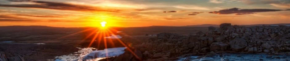
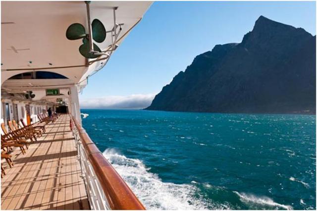
Well, after being prodded by MANY of my neighbors here in Soleil as well as other friends in the Canton-Waleska area, I have finally resolved to finish my post on the Voyage of the Viking Cruise. After departing St. John’s Newfoundland on Wednesday evening, we had our last day at sea before arriving at Bar Harbor, Maine on Friday. The sea day was nice, with the weather mild and definitely becoming warmer. We enjoyed our last gathering with Henk and Lucia, our Travel Specialist hosts, at their farewell cocktail party. It was time to say goodbye to old friends we had met on previous cruises as well as newly made friends on this cruise. Hopefully we will see you all again on one of the seven (or eight or nine, depending on who’s counting) seas.
Bar Harbor was our first port in the United States since departing Boston over a month ago thus we must go through emigration. We were scheduled to debark at 8:00 AM and we had scheduled a HAL shore excursion for 8:15. Thinking since this was a tender port, if we didn’t have a HAL tour scheduled it might be a while before we could reach shore. Unfortunately we are not yet 4-Star Mariners yet. If you have 200 sailing days with Holland America you achieve this “rank”. On this cruise, I believe about 75% of the passengers were 4-Star. One of the privileges is the ability to go directly to the tender, show your ship card and board the next available tender. For the rest of us, we must obtain a ticket form the showroom and wait until our tender number is called. So much for our plans… We arrived in Bar Harbor over an hour late, which I still do not understand. The “official” word was that we left St. Johns late, which we did, about 45 minutes late. By my calculations we had over 38 hours to make up 45 minutes but we were still more that 45 minutes late. I don’t know what the problem was, but I certainly don’t believe it was because we left St. Johns late. But I digress. Anyway, we arrived in Bar Harbor late, then had to wait for US emigration officials to board the ship and examine everyone’s passport. Fortunately, this took less time than I had expected it to. Nevertheless, we were so far behind schedule HAL cancelled our shore excursion, and we were forced to “take a ticket” and wait. We finally were able to reach the pier at about 10:30.


Scenes from Main Street, Bar Harbor
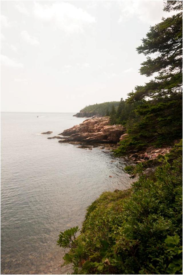
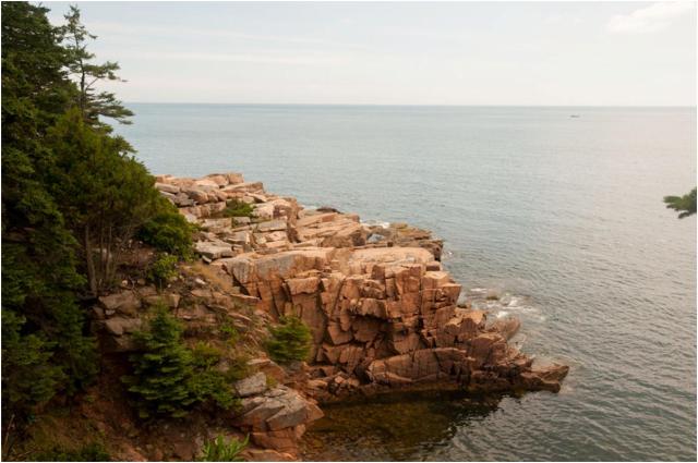
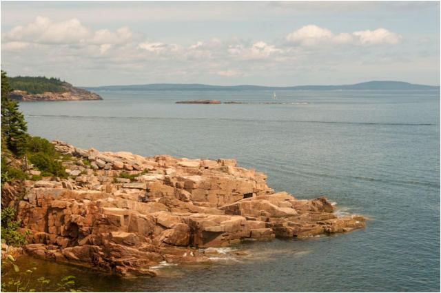
It turned out to not be as bad as we thought. We received our refund for our shore excursion, which was a tour by bus around Acadia National Park. After doing a little sightseeing and shopping (spending the money we saved from the cancelled excursion), we asked about available bus tours. As it turns out, Acadia has a wonderful bus system which leaves from the town square on a regular schedule. There are four separate lines which you can catch and even change lines at various points in the park and it is all for FREE.
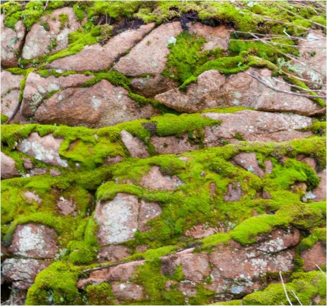
We boarded a bus and made our way into Arcadia. It is a beautiful park. We decided to leave the bus and hike a couple of miles along the shore trail. Some photos follow.


After returning to town, the girls left to do more shopping. Carl and I made our way across the square to the Bar Harbor Brewing Company. As many of you may know, I am a beer fan and even brew my own. I never miss an opportunity to seek out local brews which are not widely distributed. Like wine, beer varieties are unlimited. Unlike wine there are many, many more styles of beer than there are styles or types of wine. Currently over a hundred different styles of beer are recognized, with an unlimited variety under each style. With wine there are only 15 generally recognized styles, again with an unlimited number of varieties under each style. Generally with beer as with wine, if you like a particular style you will probably like most varieties under that style. What I like about beer is that there are sooo many more styles to choose from. Most Americans go through life drinking the commercial styles locally available. This limits your selection to only about 10 to 12 styles (and generally only 4 or 5) for most people. I like to tell people who say they don’t like beer, “you just haven’t found the right style”. Anyway, I digress again. See what happens when I write my blog from home instead of hurriedly composing it on the ship?

Bar Harbor Brewing offered us 5 ounce tastings of about 5 different brews they make. One I didn’t care for, two others were very drinkable and two were absolutely excellent! They have a red ale called “Thunder Hole Ale”, named for the cove in Arcadia which I only wish was available here. They also had a wonderful stout called “Cadillac Mountain Stout”. That is the great adventure when trying local beers, you never know what you will find.
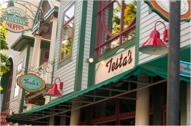
After a little more shopping, we all went to Testa’s Fine Foods for a couple of appetizers of Calamari and Onion Rings along with, you guessed it, some of the local beer. The food and the beer were both excellent.

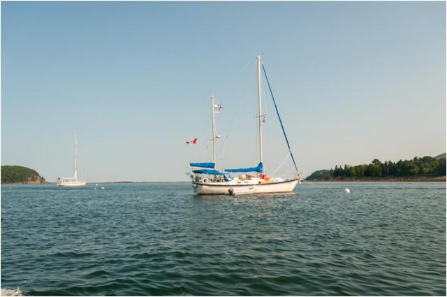
As we made our way back to the tender to return to the ship, Carl and Janet are not clapping their hands because they were glad to be leaving Bar Harbor, but instead were drying them after using the every present Purell hand sanitizer. After a long cruise, you get so into the habit that when you enter your own dining room you hold out your hand for a squirt…
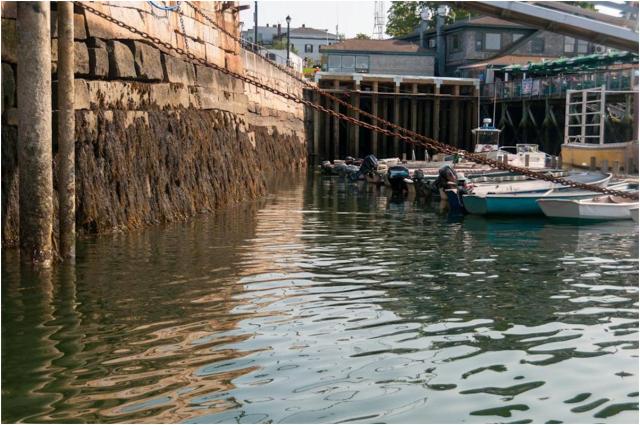
A couple of views as we were leaving the pier.
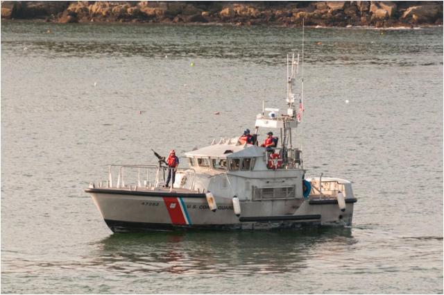
Having sailed into and out of ports in more than two dozen countries, I can’t ever remember be accompanied by a gun boat except in the United States. They were alongside us both as we came in and as we left. Not really sure of their purpose. I guess this is part of the president’s plan to keep unemployment down….
We got our packing done, and our luggage outside our stateroom before midnight. Since our flight wasn’t until 2:00PM we were not in any hurry to disembark, so we selected a late time. We had a leisurely last breakfast and then spent some time in our cabin reading. Janet was unhappy about the ships internet service. She was unable to print her boarding passes for the flight back. All of the terminals in the library were occupied by people just trying to burn up their internet minutes, ridiculous. I would rather just loose mine than waste the time. The Internet supervisor told her she could come back later when it was not so busy. What he didn’t tell her was that they now charged for printed pages and cut off the printer at 10PM because they could not get the charges on your final statement after that time. Come on Holland America, for what everyone spends you could afford the printing of a few boarding passes.
Disembarkation could not have been easier. Passing thru customs consisted of handing the officer your completed form and allowing him to glance at your passport. The ride to the airport was effortless and the flight to Atlanta uneventful. Our only problem was our luggage. We arrived so early at Logan, our luggage got on an earlier flight to Atlanta so we had to hunt it down before calling our limo service. Once called, Top Hat Limo was there in about 10 minutes for a pleasant ride home.
In conclusion, we had a very nice trip and visited some very interesting ports. The ship’s staff were excellent although at times they seemed to be understaffed. The onboard programs were very good and we had the opportunity to attend many excellent lectures on a wide variety of subjects. There were many places I would enjoy returning to and spending additional time, and others that I am glad I have been but don’t have any overwhelming desire to return.
Regarding the Maasdam and Holland America, I was disappointed. I don’t know whether it was because of spending cut-backs initiated by the company or some other factors, there were many problems which I feel could have been avoided. I detected an inconstancy with the Captain which I have not found on other cruises. Communications from the bridge were poor and often events were not publicized well. Again, perhaps this was beyond his control, but nevertheless it made for some less than ideal times. The layout and organization on the Lido was chaotic. There were times I simply skipped lunch rather than compete with the rudeness exhibited by some in the meal lines. Please don’t misunderstand me, the majority of passengers were pleasant and fun to be with but there seemed to be an inordinate number of those who felt the world revolved around them. I will have to re-evaluate whether to take a Holland American Cruise the next time and it is a shame because they have some of the most interesting port call of any line.
Sorry to end the blog on a negative note, but remember – we did have fun and do not regret making the trip. Carl and Janet were excellent traveling companions whom we hope to do a lot more traveling with. The photo opportunities were great and the beer was good…
Till next time…
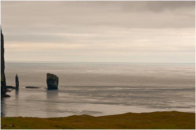
Newfoundland and Labrador became the 10th province of Canada in 1949. The first use of the name Newfoundland was in 1497, in an English registry recording the discovery of Terra Nova or the “new found land.”. While many Europeans saw or visited Newfoundland, it was John Cabot while sailing for Henry VII in 1497 who garnered mudch interest in the are with his reports that spoke of “the sea swarming with fish, which can be taken not only with the net, but in baskets let down with a stone.” Thus began the great years of fishing when vast fleets from England and France sailed and fished the waters of Newfoundland. The decision to become part of Canada took many years and two public referendums. Today, St. John’s is an interesting seaport as well as the capital of the province.
We arrived in St. John’s at 5PM on Tuesday the 14th. The sail-in was very nice and the weather looked promising. Kay and I planned to go ashore for dinner on George Street, a shore pedestrian street well known for its many clubs, pubs and restaurants. Unfortunately shortly after we docked it clouded and began to rain quite hard. As a result we elected to stay onboard for dinner. The weather cleared during dinner and we ventured out to explore the city. Along with Janet and Carl, we made our way to George Street and found an outside table at an Irish Pub “O’Reilly’s”. They provided excellent entertainment by way of an Irish folk singer and excellent local beer. While there we were joined by our new friends Donna and Rex from Texas. We spent a very pleasant evening downing a couple of pints of the local stout.
Wednesday morning we had an early (7:30) excursion. Although it was rainy and foggy the excursion was excellent. We traveled to Signal Hill, then toured downtown and finally made our way to Cape Spear, the eastern most point of North America. The photo opportunities were not what I would have liked, but with the weather you take what you can get.
Signal Hill is Canada’s second largest national historic site and offers a spectacular view of St. John’s, its harbor and the adjacent coastline. Cabot Tower, built in 1897 at the summit, commemorates the 0th anniversary of John Cabot’s Newfoundland discovery. This is where Guglielmo Marconi received the first transatlantic wireless signal on December 12, 1901. Amazing how far we have come in only 111 years! It is also noted as the last North American landmark Charles Lindberg sighted during his solo flight to Paris in 1927.
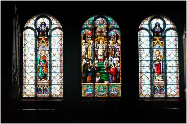
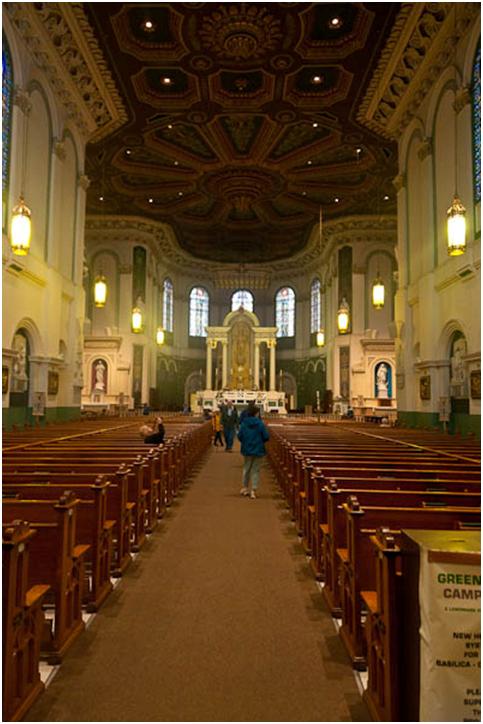
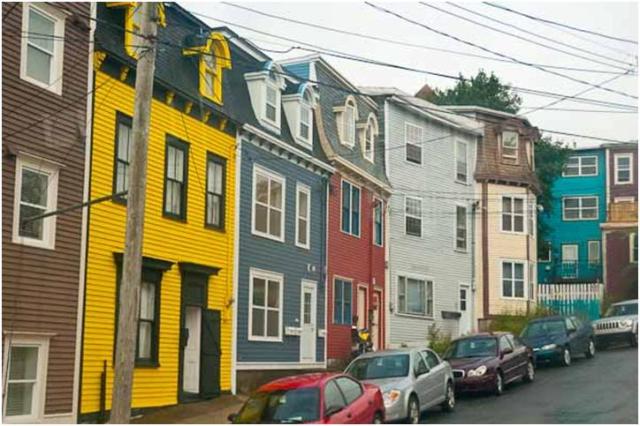
While in the city, we visited the beautiful Basilica Cathedral of St. John the Baptist and had an opportunity to see the beautiful “jelly bean” colored homes along Gower Street.
As usual for this blog, I will post photos will little commentary due to the formatting difficulties I have been having. Enjoy.
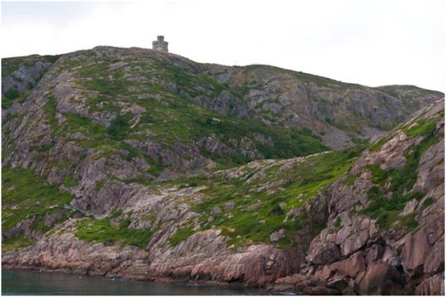
Cabot Tower on Signal Hill during the sail-in


Just a prelude to the colorful city of St. John’s

The “narrows” taken from Signal Hill. This passage of just over 500 feet wide makes the harbor an extremely protected haven for ships

The Maasdam in the distance
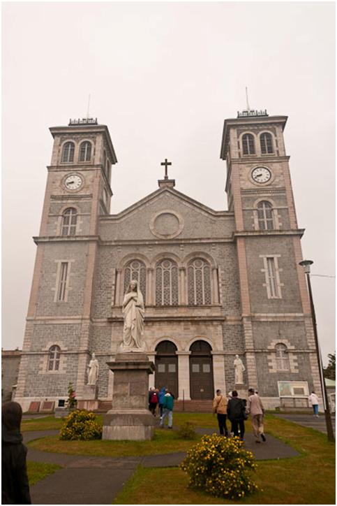
Basilica of St. John the Baptist
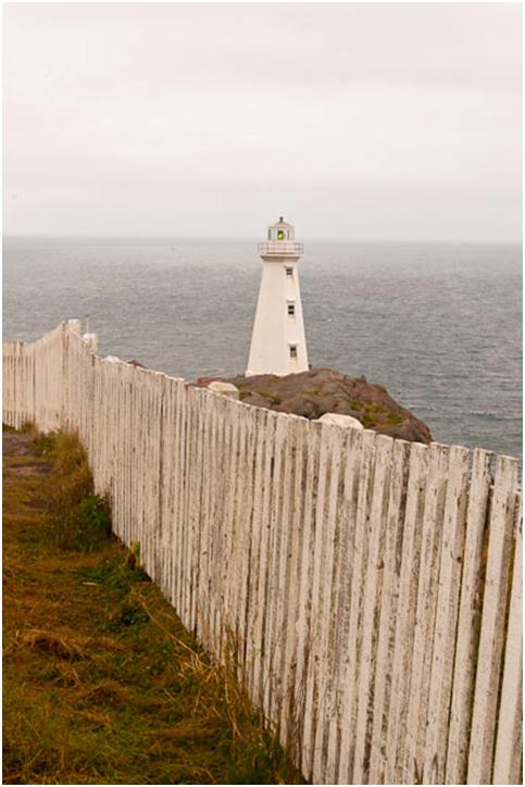
Lighthouse at Cape Spear


The eastern-most point of North America


This is one of the Newfoundland Constables who was horseback. This officer like everyone we met in St. John’s was incredibly friendly. You could feel the locals here weren’t just being nice hoping to get an Yankee dollar or two. Everyone was genuinely interested in you and hearing your story as well as sharing their story with you. St. John’s is one of those places I would certainly enjoy returning to and spending more time.
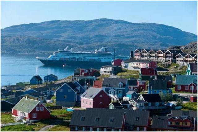
Greenland, an island comprised for the most part of vast ice fields is home to approximately 57,000 inhabitants. In the native language, Greenlandic, the name of the country is Kalqaalit Nunaat and is the world’s largest island with an area of 840,000 square miles. The capital is Nuuk and it is a dependency of Denmark. Greenland extends 1,660 miles from north to south, and more than 650 miles from east to west. It consists of vast interior ice fields measuring up to 9,800 feet in depth and a mountainous ice free rim around the southwest and southeast coast. The ice fields cover the ancient rocks of the Greenland Shield which is closely related to the Canadian Shield. The climate is extremely cold in the north and in the interior but during the short summer months the mean temperature along the southwestern coastline can be in the mid 40’s. In southern Greenland ruins from Viking communities relics date back well over 1,000 years.
Qaqortoq (pronounced” Cocker-tock”) was originally known as Julinehab, named to honor Queen Juliane Marie, who was married to the King of then-unified Norway and Denmark. Qaqortoq was established by Norwegian merchant Anders Olsen in 1775. Qaqortoq today is the home of about 3,500. It is pleasant town which on the day we visited was bright and sunny. One of the features Qaqortoq is famous for is its fountain. It is not a particularly impressive fountain, but it is the ONLY fountain in the country! Due to the severe winters, fountains are not a normally found feature in Greenland.
We spent some time walking the town streets and purchasing a few souvenirs most locally made. The Danish Krone is the accepted currency although American dollars were readily accepted at a very favorable rate. I also was able to spend the last 50 Krone from the Faeroe Islands.
On our departure there were a considerable number of ice bergs, though not nearly as many as we saw in the Antarctic.


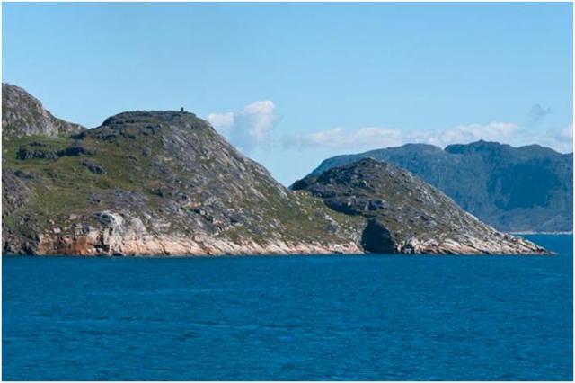

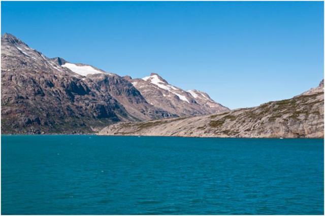
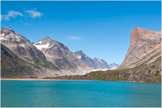
On most maps the southern tip of Greenland looks solid, but it actually consists of many channels with Prince Christian Sound being one of the largest as can be seen on this map.
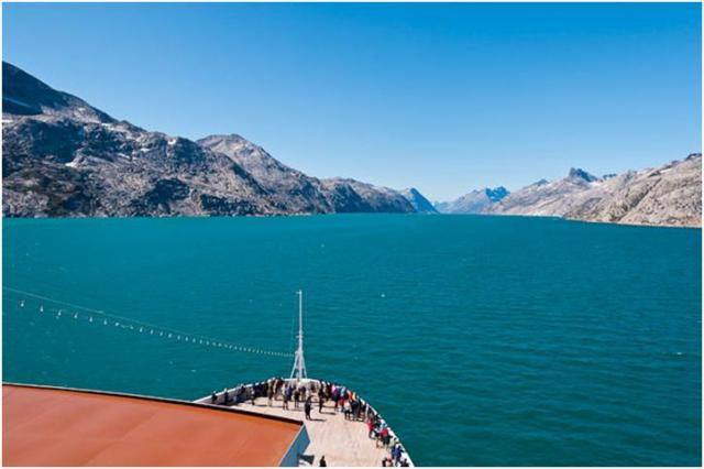
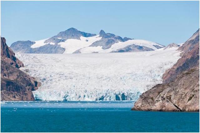
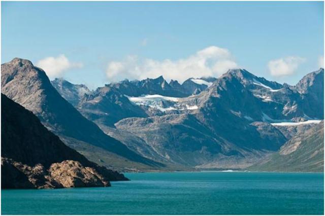
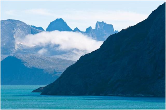
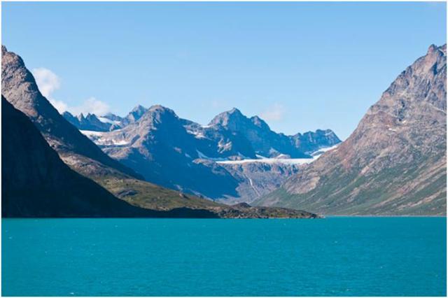
Well, we finally did get to cruise the Prince Christian Sound at the southern tip of Greenland. During our west-east transit the captain decided it was too dangerous to try and navigate the passages of the sound. Fortunately today the weather was perfect, bright and clear and the wind was not too severe.
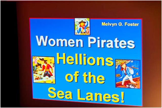
We did not reach the sound until about 1:00 PM but the morning was not idle. I attended two excellent lectures by our guest Explorations Speakers. The first was by Professor Melvyn Foster whose “hobby” is seafaring history. He presented an excellent lecture about a topic I really wasn’t familiar with “Women Pirates”.
The next lecture was by Professor Paula Lupkin whose expertise is in architectural history. She has given several lectures about the various ports we have visited, but in her biography I noticed that she was working on a book regarding how beer helped shape the landscape in America from the late 1800 through prohibition. I asked her about this and she said several others had inquired as well. As a result she agreed to do a lecture on the subject. It too was excellent and very enjoyable. It was a smaller audience than the other lectures but those of us there were true beer aficionados and a lively discussion followed her lecture.

After enjoying these lectures and then a quick lunch (I missed the Mariner Society’s Brunch to listen to the beer lecture). I went up to deck 12 and quite literally tied myself to an antenna tripod in order to view and photo the sound. On the top deck with the wind coming down the sound, the wind speed was probably approaching 70 knots and it was too strong to just stand and photograph without being anchored to a rail or mask. I remained topside for about an hour and then retired to our lanai stateroom to photograph from the lower deck.
Below are a few of the more than 500 photos I took. I will try to make a few comments but can’t guarantee that the comments will appear with the photos…


Here the ship was heading toward the entrance of the sound.
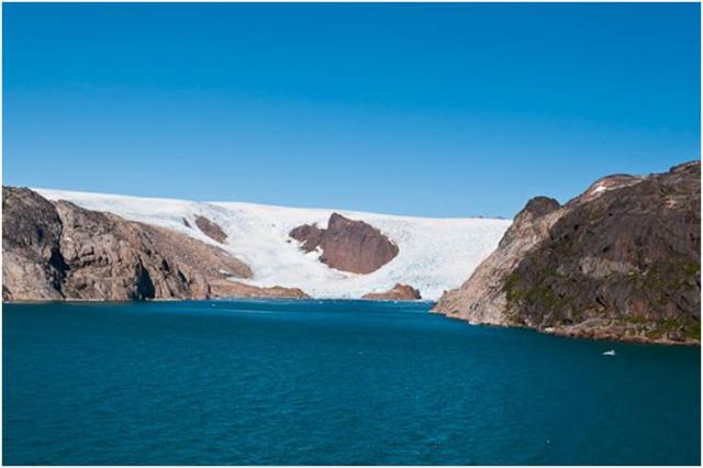
We had the opportunity to see a number of glaciers and received an excellent lesion in glaciology form our resident guide.
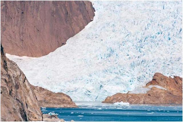
In this close-up you can see some small bergs being calved into the sound.


We passed this small village, which has about 130 persons living here, 20 children in school. It is truly in the middle of nowhere. When the ship was sited, many people were running along the rocky coast to wave. After we just passed the village three small boats came from the inlet behind the village. They each has two adults and several children. They were excited and continued to follow us for a while we waved at each other. The captain blew the ships horn in acknowledgement and it seemed to thrill the villagers. This must have been the most exciting thing for them is a while.


As we left the sound the wind was blowing so strongly it caused the ship to list to one side. I got this photo to illustrate the strength of the wind. If you compare the horizon to the deck you can appreciate the power of the wind.
Early tomorrow morning we will be visiting Qaqortoq, Greenland.
x
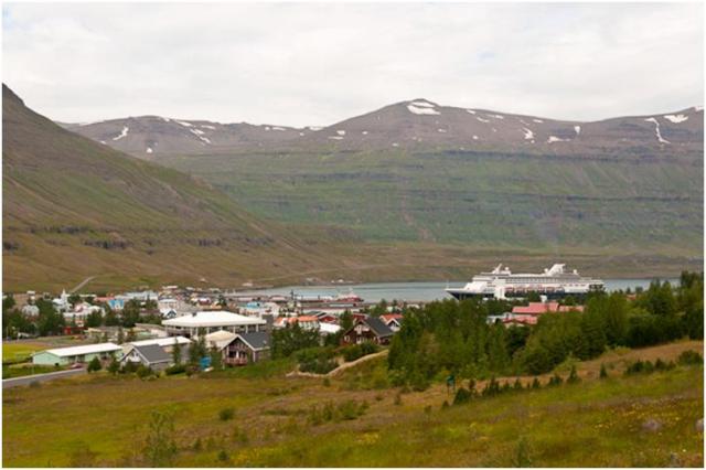
We arrived in Akureyri after traveling down a beautiful fiord for about 15 miles. The weather was looking much better, sunny and a pleasant 60 degrees.
This town of 14,000 is the second largest city in Iceland. It is located on the north-western part of the island, just below the Arctic Circle (which we crossed twice during the night). Its setting is superb and sunny days are the norm in this small and tidy city planted beneath perpetually snow-capped peeks near the head of Eyjafjorour. Akureyri began as a trading center just before the Dnish Trade Monopoly of 1602 came into effect. Although the town was used for commercial enterprises, no one actually lived there as all the settlers maintained rural farms and homesteads. After business had boomed for a century and a half, Akureyri’s first actual residence was built in 1777. By the late 1700’s the town had grown to a whopping 10 residents, all Danish traders. By the turn of the century, Akureyri numbered 1370 people. The Akureyri Fishing Company is Iceland’s largest, and the city’s shipyard is also the busiest in the country. Before the decline in herring stocks off northern Iceland, herring salting was the city’s largest industry. Fishing remains important, but the emphasis is now on trawling, canning and freezing larger fish. Akureyri’s expanding industrial base includes such diverse enterprises as brewing, food processing and tourism.
Today Kay and I took a private tour with a couple from Fort Worth, TX. We had communicated via email having met on the Cruise Critic Forum. Even though we have all been on the ship for almost four weeks, we didn’t actually meet until a couple of days ago. Donna and Rex Hunt are a very pleasant couple and we had a most enjoyable day sharing a vehicle and driver/guide. We had a seven hour private tour with a most excellent guide for a fraction of the cost of a ship excursion which would not have experienced nearly as many sites. Thank you Donna and Rex for allowing us to share this trip you planned.
As has been the case this trip, the formatting after uploading the blog has been very poor. Therefore I will mostly just post some photos from the wonderful sites we visited.
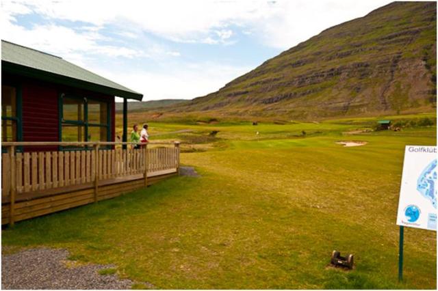
First, just a couple more facts about Iceland. Although it is a very small country, it contains the largest glacier in Europe and also the largest desert in Europe. Akueyri also has the northern most 18 hole golf course in the world. We again were able to visit the fissure (which runs the length of the country) where the North American and European tectonic plates separate. I have a photo of Kay standing with one foot technically in Europe and one in North America! Also in some of the photos you may notice there was a lot of wind. It is evident in some of the lake photos. Our guide who is a native of the city said it was the most wind she has ever experienced.


 The Maasdam at dock viewed from across the fiord


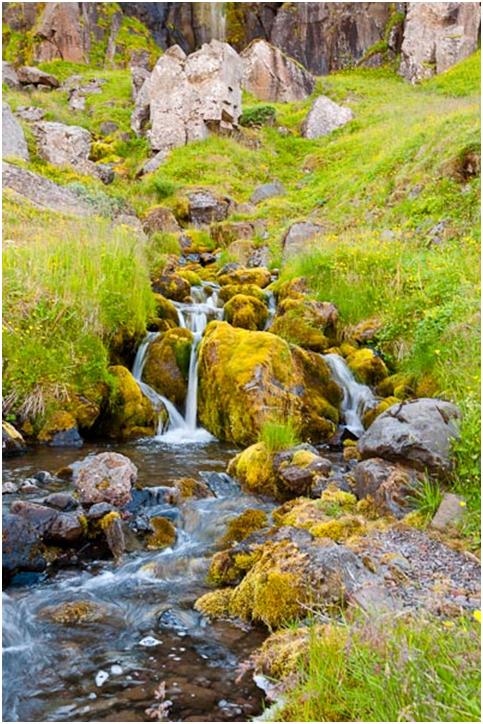
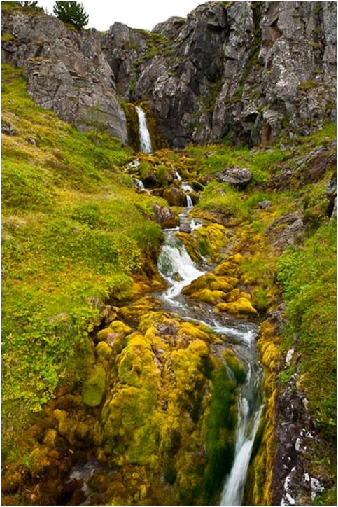
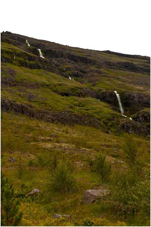
Godafoss Falls – Legion is this is where the king threw all the old idols after adapting Christianity for Iceland
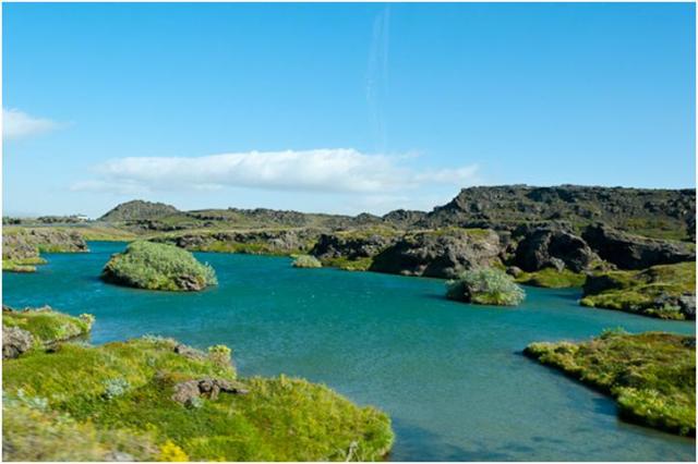
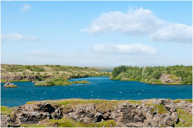
The next several photos are of Lake Myvatn. It is a most unusual and beautiful lake which was formed from a large volcanic area which was partially covered with water. Volcanic craters and collapsed magna chambers are still very evident.
 Notice the windblown ripples on the water


Kay and Donna, wind blown by the 40-50 mph winds.

Kay with one foot on the North American plate and one on the European plate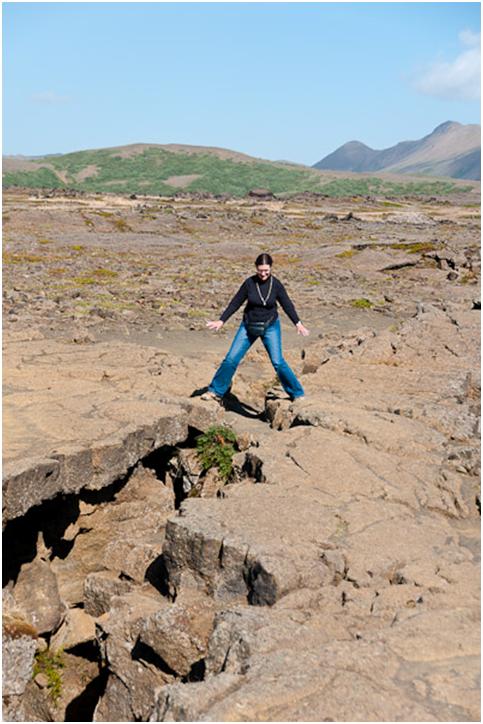
A hydro-thermal power plant. This one has over 30 bore holes which captures the super heated water to generate electricity.
Under these metal plates are holes where local l adies bring bread to bake by the natural volcanic heat of the ground. It is black bread which takes 24 hours to cook. They then sell it to local shops and hotels. I had sample and it was very good.
A Public Hydro-Thermal Bath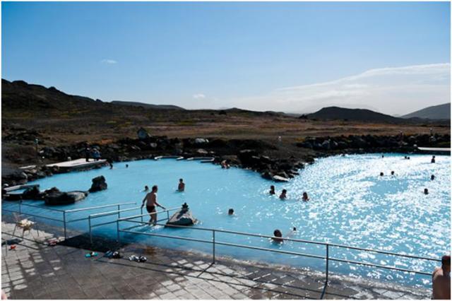

x
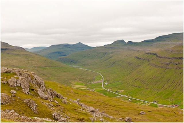
Seyðisfjörður is a town and municipality in the Eastfjords of Iceland at the innermost point of the fjord of the same name. As of January 2011, the town has 668 inhabitants.
A road over Fjarðarheiði mountain pass connects Seyðisfjörður to the rest of Iceland; 27 km to the ring road and Egilsstaðir. Seyðisfjörður is surrounded by mountains on all sides with most prominent Mt. Bjólfur to the West (1085m) and Strandartindur (1010m) to the East. The fjord itself is accessible on each side from the town, by following the main road that leads through the town. Further out the fjord is fairly remote but rich with natural interests including puffin colonies and ruins of former activity such as nearby Vestdalseyri, from where the local church was transported.
Town settlement in the Seyðisfjörður area started in 1848. The town was settled by Norwegian fishermen. These settlers also built some of the existing wooden buildings in the village. Another now deserted settlement nearby in the fjord, Vestddalseyri was the site for the world’s first modern industrialized whaling station. It was established in 1864 by renowned American whaler Thomas Welcome Roys and run by him and his workforce until 1866. Both settlements served primarily as fishing and trading posts. The first telegraph cable connecting Iceland to Europe was shored in Seyðisfjörður in 1906, making it a hub for international telecommunications well past the middle of last century. In 1913 a dam was made in the main river, harnessing power for the country’s first high voltage AC power plant together with a distribution network for street lighting and home use, also the first of its kind in Iceland. Seyðisfjörður was used as a base for British/American forces during World War II and remnants of this activity is visible through the fjord, including a landing strip no longer in use and an oil ship El Grillo that was bombed and sunk. It remains a divers wreck at the bottom of the fjord.
With the recent demise of the local fish-processing plant the village has shifted its economy to tourism. It still remains a significant fishing port on the east coast of Iceland with harbors, ship construction facilities and a slip.

In this beautiful small village we did not do any paid excursions. We decided to just walk thru the village and then do some hiking in the countryside. This is a land of glacier cut valleys and waterfalls. It was a great place to get some exercise and fresh air. We hiked about 8 miles today.


We even found a 9 hole golf course. We visited the clubhouse but no one was home. We did talk with a couple of ladies who were about to play.

x
Torshavn is the capital and largest town of the Faroe Islands. It is located in the southern part on the east coast of Streymoy. To the north west of the town lies the 347-metre (1,138 ft) high mountain Húsareyn, and to the southwest, the 350-metre (1,150 ft) high Kirkjubøreyn..
The Vikings established their parliament on the Tinganes peninsula in 850 CE, thus Tórshavn was made capital of Faroe Islands and has remained so ever since. All through the Middle Ages the narrow peninsula jutting out into the sea made up the main part of Tórshavn. Sources do not mention a built-up area in Tórshavn until after the Protestant Reformation in 1539. Early on, Tórshavn became the center of the monopoly trade, thereby being the only legal place for the islanders to sell and buy goods. In 1856, the trade monopoly was abolished and the islands were left open to free trade. The town has grown rapidly ever since the turn of the 20th century into the undisputed administrative, economic and cultural center of the Faroes.
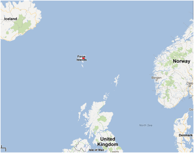


We were welcomed to the Faroe Islands with unusually nice weather (for the islands!). It was overcast but no rain and the temperature was in the high 50’s. Today we have a tour arraigned with Cruise Specialists our travel agent. We traveled from Torshavn, the capital in the southern part of Streymoy the largest of the 18 islands making up the Faroes northward. No matter your locations on the islands, you are never more than 3 miles from the ocean. Torshavn has 17,000 of the approximately 48,000 inhabitants of the Faroes. All but one small island is occupied.
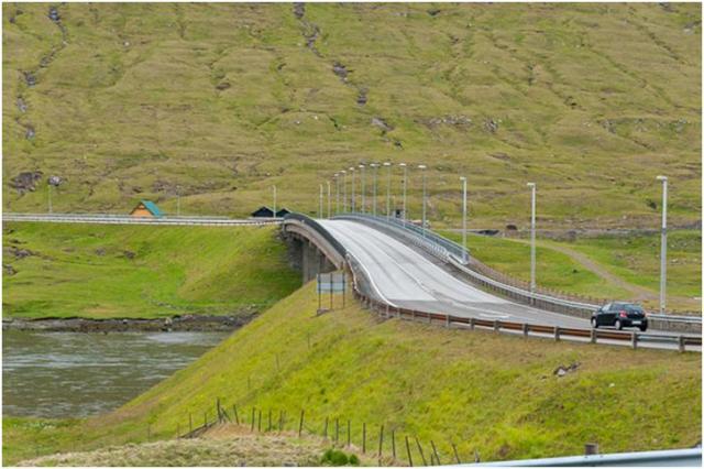
I was surprised by the development of the country. I guess I am not really sure what I expected but not the modern well developed country I encountered. Most of the islands are amazingly close. In fact the photo below is of a bridge across the Atlantic Ocean which connects the two largest islands.
The islands consists of many fiords and glacier carved alleys which give rise to a beautiful landscape. There are no native forests on the islands but a few small clusters of trees imported from the southern tip of South America are beginning to flourish.


To the left side of the fiord you can see a salmon farm. Fishing and fish farms are the largest industry in th islands.


A few hardy flowers flourish in this harsh windy climate.
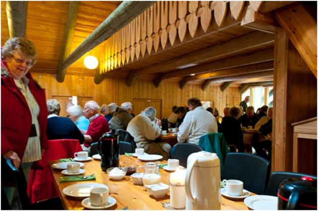
We crossed the Atlantic bridge from Streymoy island to Eysturoy island. We then traveled to the northern tip to the village of Gjogv. This a very picturesque seacoast town where we had a morning treat of pancakes and coffee at the local hotel/hostel.
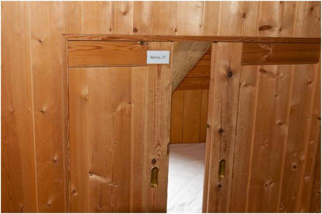
Along the wall of the dining room there were cubicles which contained a sleeping area. This was bed No. 37 located behind sliding doors.
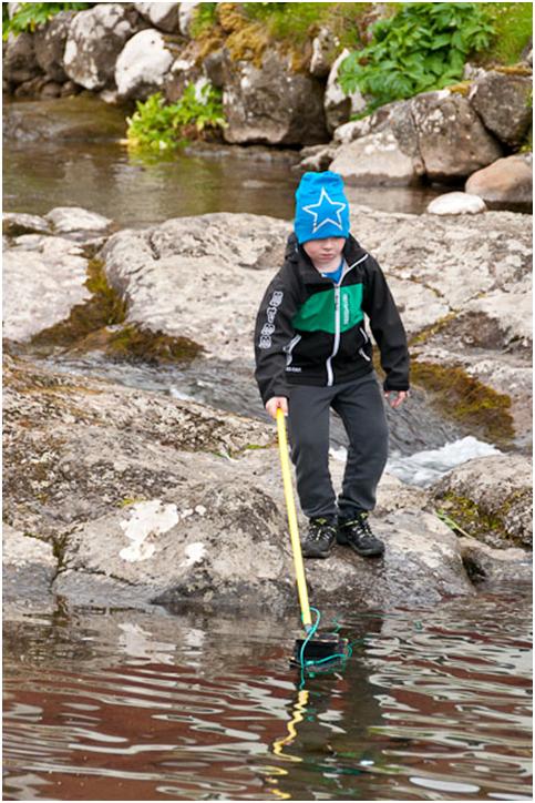
This young local boy was playing with his boat attached to a string and pole. He was “sailing” his boat in a small pond formed from the stream flowing from the mountains to the ocean.


Inside this church as in almost all churches in Scandinavia, there is a ship suspended from the ceiling with the ship facing the pulpit, signifying a safe harbor.

There were many homes and public building covered with the traditional grass roof


. 
The glacier shaped terrain is very obvious in the above two photos.

A view of the city of Torshavn taken from the road above the town.

The harbor in Torshavn
Today, Wednesday we are arriving in Seydisfjordur, Iceland. We have no tour planned but expect to walk the small town and perhaps hike outside of town.
x
Dublin, meaning “town of the hurdled ford”, is the capital and most populous city of Ireland. The English name for the city is derived from the Irish name Dubhlinn, meaning “black pool”. Dublin is situated near the midpoint of Ireland’s east coast, at the mouth of the River Liffey and the centre of the Dublin Region.
Originally founded as a Viking settlement, it evolved into the Kingdom of Dublin and became the island’s principal city following the Norman invasion. The city expanded rapidly from the 17th century; it was briefly the second largest city in the British Empire and the fifth largest in Europe. Dublin entered a period of stagnation following the Act of Union of 1800, but it remained the economic centre for most of the island. Following the partition of Ireland in 1922, the new parliament, the Oireachtas, was located in Leinster House. Dublin became the capital of the Irish Free State and later the Republic of Ireland.
The City of Dublin is the area administered by Dublin City Council, but the term “Dublin” normally refers to the contiguous urban area which includes parts of the adjacent local authority areas of Dún Laoghaire–Rathdown, Fingal and South Dublin. Together, the four areas form the traditional County Dublin. This area is sometimes known as the Dublin Region. The population of the administrative area controlled by the City Council was 525,383 in the 2011 census, while the population of the urban area was 1,110,627. The County Dublin population was 1,273,069 and that of the Greater Dublin Area 1,804,156. The city’s population is expanding rapidly, and it is estimated by the CSO that it will reach 2.1 million by 2020.

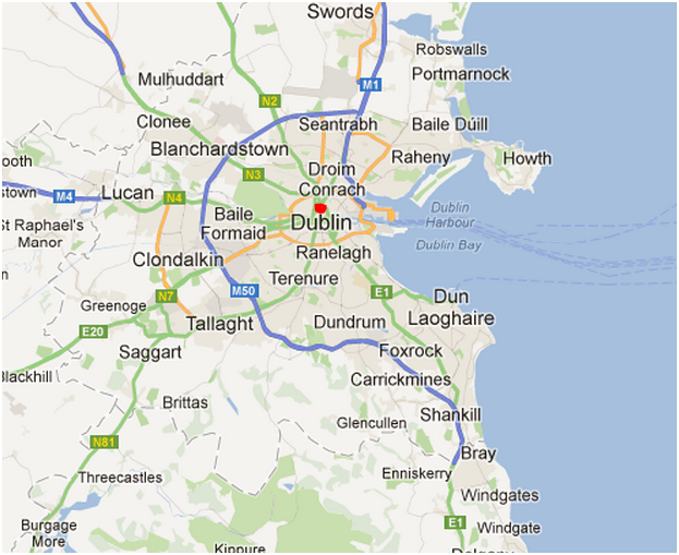
We arrived in Dublin around noon and will stay overnight with departure at 5PM on Sunday. The afternoon of our arrival we have a “City Tour” by coach and a stop at Dublin Castle for a tour. We felt this would help us get orientated to the city. The weather was surprisingly good. We had sunshine and temperatures in the 60’s. I am not posting a large number of photos for two reasons. I have had a great deal of difficulty with the post because the photos will not format properly. Also for the most part the weather has not been conducive to obtaining good photos.
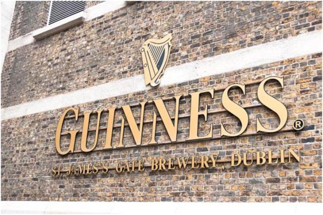
The second day, we planned to get a hop-on, hop-off bus but although it was cloudy there was no rain. As a result we decided to walk the town. The ship supplied a shuttle bus from the pier to the center of town, about 3 miles and 15-20 minutes ride. After arriving in town we walked around St. Stephens Green since it was not yet open. We then began to make our way west in the city towards the Guinness brewery at St. James Gate. I knew Guinness was an institution in Dublin but did not realize just how important it was to the city. Author Guinness obtained a 9000 year lease in the mid 1700 for about 65 acres of land in the city where the present brewery is located. Through the years Guinness has contributed greatly to the development of the city and its parks as well as housing and employment.
We enjoyed the brewery tour and also a couple of pints while looking out over the city in the Gravity bar atop the Guinness Storehouse. As we left the Storehouse it began to rain and we got quite damp on our approximately 2 mile walk back to the bus pickup. Along the way we stopped to have a traditional fish and chips lunch.
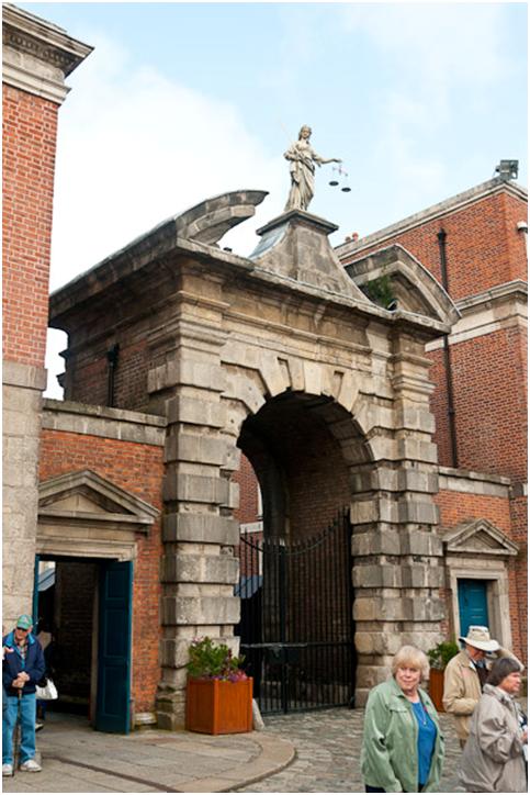
Dublin Castle Gate.

In town we were seeing zombies everywhere, young people dressed in tattered clothes and covered with blood. Only later did is see a sign which was promoting a “zombie walk”.
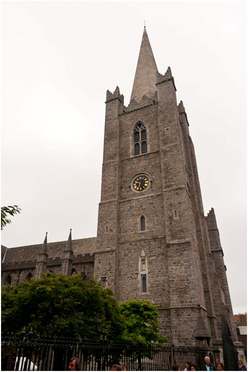
St. Patrick’s Cathedral
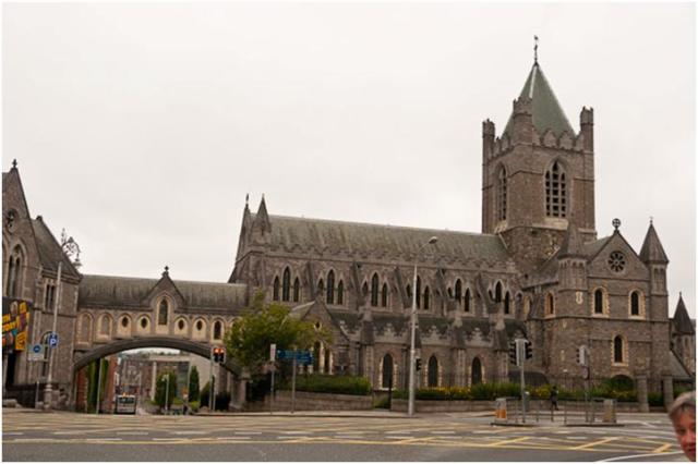
Christ’s Church
There are so many old and beautiful buildings after a while you almost take them for granted. It is hard to believe that most of them are between 800 and 1200 years old.

It is neat (and useful for out of towners) that they remind you on the pavement which way to look for traffic.

Here we are enjoying a sample before reaching the Gravity Bar where we had our full pint.
All in all it was a great day but could have been made better if the weather coorporated. England and Ireland are certainly places we hope to return for a more full exploration someday.
Tomorrow is a sea day and on Tuesday we will be arriving in the Faeroe Islands. I am looking forward to this out of the way location and just hope the weather is good.
Plymouth is a city and unitary authority area on the south coast of Devon, England, about 190 miles south-west of London. It is situated between the mouths of the rivers Plym to the east and Tamar to the west, where they join Plymouth Sound. Since 1967, the City of Plymouth has included the suburbs of Plympton and Plymstock, which are on the east side of the River Plym.
Plymouth’s history goes back to the Bronze Age, when its first settlement grew at Mount Batten. This settlement continued to grow as a trading post for the Roman Empire, until the more prosperous village of Sutton, the current Plymouth, surpassed it. In 1620, the Pilgrim Fathers left Plymouth for the New World and established Plymouth Colony – the second English settlement in what is now the United States of America. During the English Civil War the town was held by the Parliamentarians and was besieged between 1642 and 1646.
Today the city is home to around 250,000 people, making it the 19th most populous city in the United Kingdom. It is governed locally by Plymouth City Council and is represented nationally by three MPs. Plymouth’s economy is still strongly influenced by shipbuilding, but has become a more service-based economy since the 1990s.


We came into Plymouth harbor early and the weather looked typical of what we have been seeing, cloudy and rainy.
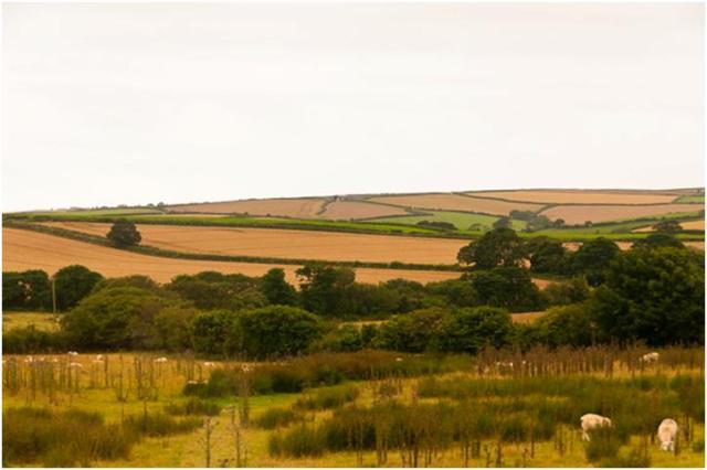
Today we had an excursion to the coastal town of Polperro on southeast Cornwall coast. Polperro is located about 25 miles west of Plymouth. Polperro is a beautiful harbor fishing village with a population of just over 5000. Today its major industry is tourism due to its beauty and location. It is popular for both native Great Britains as well as foreign visitors.
The coach ride revialed beautiful countryside with rock walled, lush green fields. Many sheep and pig were also seen.


The village was very lovely with narrow winding streets. There were many opportunities to sample the fares the area is famous for. For lunch we had a local patsy, a pastry filled with beef and potatos. It was quite good and very filling.
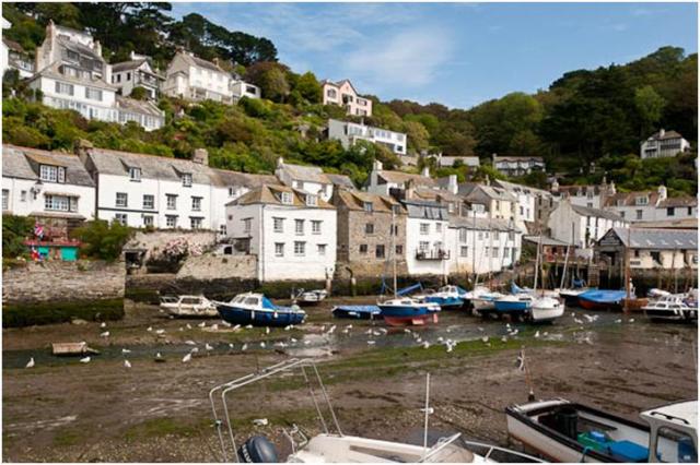
This small harbor actually had a lock which allowed for dry docking. When the tide was low the lock could be closed. When opened and the tide was in the area was flooded and the boats could reach the sea.
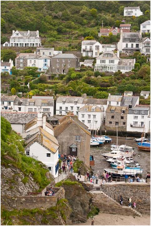
The village consists hills filled with houses, some almost defying gravity.


We took this trail to one of the highest points in the village for a wonderful view of the bay.
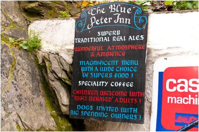
Kay humors me often by accompanying me into pubs to obtain a local brew. This pub the Blue Peter Inn was full of wonderful ambiance and the bar keep was glad to assist me in selecting my drink.
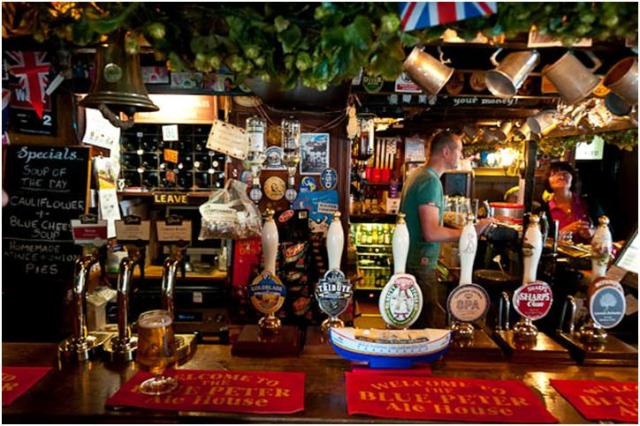
I decided on a “Sharp’s Own”, a beer brewed in Cornwall in the old “real ale” fashion. It was a dark, malty brew served at about 50 degrees and hand pumped. The real ales do not have enough carbonation to force dispense from the spigot. It was wonderful. I could have easily had 3 pints instead of the one I limited myself to. After all I did have to find my way back to the coach for the return trip to the ship. I will remember this brew and attempt to reproduce it when I return home.
We will be in Dublin tomorrow and one of the things I look forward to is visiting the Dublin Brewery.
Southampton is the largest city in the county of Hampshire on the south coast of England, and is situated 75 mi south-west of London and 19 mi north-west of Portsmouth. Southampton is a major port and the closest city to the New Forest. It lies at the northernmost point of Southampton Water at the confluence of the River Test and River Itchen with the River Hamble joining to the south of the urban area.
The city represents the core of the Greater Southampton region, and the city itself has an estimated population of 239,700 Southampton combines with Portsmouth to form a single metropolitan area; with a population of over a million this makes the region one of the United Kingdom’s most populous metropolitan areas. The city’s name is sometimes abbreviated in writing to “So’ton” or “Soton”, and a resident of Southampton is called a Sotonian.


Sal
We arrived in Southampton with weather alternating between rain and sunshine; sometimes within a five minute period. This was pretty much the pattern for the day. It is very difficult to know how to dress! Our guide who took us to Salisbury and Stonehenge said the British, especially here in the southern part of the country, were peculiar about their dress. Since the temperature doesn’t vary a great deal year round here, the locals dress according to the season not the weather. She said, just because you see a local wearing a t-shirt and shorts in August and it’s raining and 58 degrees doesn’t mean he is not cold, it’s just that he is dressed for the season… I am not sure I could ever get accustomed to this weather.
We left early and journeyed through several small towns and villages and finally through Salisbury before reaching the Salisbury plain and finally to Stonehenge. The scenery was beautiful even if the weather wasn’t.
Stonehenge is on the Salisbury plain, much of which is owned by the military and leased for farming. There is very little around the site except for a parking lot and a few vendors. From the parking lot you pass under the highway to reach the relic. The crowds were huge, partly due to the Olympic overflow from London.
The relics themselves compromise only a small area, but as our guide explained the original builders utilized the entire plain and similar stone circles extended for miles and miles. Some are smaller and others much larger. Stonehenge is famous simply because of it relative state of preservation.

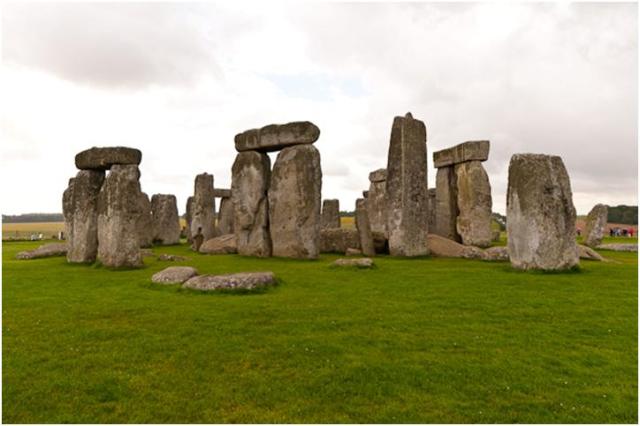
Here are just a couple of photos of Stonehenge. I was surprised that I was able to get pictures with few people in them.
Kay, Janet, Carl and I walked out to some of the burial mounds, only about a 15 minute walk. Again the weather turned nasty and we got wet before getting back. Fortunately we were prepared!
After leaving Stonehenge we returned to Salisbury where we were able to walk the grounds of the Salisbury Cathedral and explore some of the town. Unfortunately we did not have time to go inside the Cathedral. I believe you could probably spend half a day inside. Visiting this place brings Ken Follett’s Pillars of the Earth to life.


In this detail you can see the beautiful Gothic architecture.. Also seen is the scaffolding alongside the building. Apparently restoration is underway almost 100% of the time

Some of the other local buildings were quite interesting as well.
On our return to Southampton, we asked our guide if we might be let off in town to walk back to the pier. She and the driver were very accommodating, but we were surprised that we four were the only ones who wanted to make the 20 minute walk. After leaving the bus we walked over to High Street to make our way back. On High Street is located The Bargate. This was originally part of the original wall of Southampton and a guild meeting place.

We also passed the anchor of Queen Elizabeth II, a monument on High Street.

We cut across Porter’s Lane and walked along part of the old city wall. Adjacent to the wall we stopped at the Platform Tavern where I had a pint of their microbrew “Dancing Man” this was a real ale, a style which almost disappeared but has been resurrected in Gr. Britain by a few devotees. After having the opportunity to sample one, I am glad it survives. Real ale is cask conditioned and has no added carbonation. It is not filtered or pasteurized. Due to the low carbonation, it must be hand pumped from the cask to the glass, and is served at about 50 degrees. It was an excellent brew.


After a very satisfy satisfying day, we had an excellent dinner and retired early. We will be in Plymouth tomorrow.
